Google Maps Beefs Up Its Live Transit Information With Updates For NYC, DC And Salt Lake City

One of the things that’s frustrating about Apple’s Maps is that you don’t get the integrated transit information that’s the lifeblood of living in a place like New York City or San Francisco. Google Maps has always had that information integrated into the product, which is a huge help for people who live in those metropolitan areas. The difficulty for Google is to keep up with all of the transit options, especially when it comes to live information. Today, it announced updates for NYC, D.C. and Salt Lake City, which will show you live departure times for seven lines on the NYC Subway system (MTA) and buses, subway in D.C. (Metrorail) and trams in Salt Lake City (UTA). There are more than 800 cities with transit information available in Google Maps, but these three cities are getting more attention, since they have the most riders. Google Maps has been a massive success since launching on iOS last December, and transit information is a huge advantage. Here’s what Soufi Esmaeilzadeh, partnership development manager for Google Maps, had to say about the update: With transit information in Google Maps you get pick-up locations, departure times, estimated travel time, and even fare amounts for 800 cities* across more than 25 countries around the world – that’s information for 100 million miles of daily public transit trips at your fingertips. These are clearly not easy problems to solve, since most of the information relies on the transit lines themselves reporting information in real time in a way that Google can access it. Those are relationships that the company has built over the years, which allows it to seamlessly integrate the data into its offerings. As I mentioned, this was the one thing that immediately turned me off of Apple Maps. Having to rely on third-party applications that are kind of woven into Apple’s service just didn’t cut it for me. When you are waiting to get on a bus or train, you need that information quickly. Seeing delays, for example, in real time, can help you decide on whether to taxi and give you enough of a heads up to let someone know that you’re going to be late. There’s nothing worse than standing there waiting for a train and having no idea when it’s coming. Google is actively seeking more transit partners, and has an entire site dedicated to it in which they
8554816024_1596687b79_z

One of the things that’s frustrating about Apple’s Maps is that you don’t get the integrated transit information that’s the lifeblood of living in a place like New York City or San Francisco. Google Maps has always had that information integrated into the product, which is a huge help for people who live in those metropolitan areas.

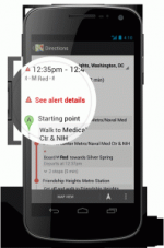
The difficulty for Google is to keep up with all of the transit options, especially when it comes to live information. Today, it announced updates for NYC, D.C. and Salt Lake City, which will show you live departure times for seven lines on the NYC Subway system (MTA) and buses, subway in D.C. (Metrorail) and trams in Salt Lake City (UTA). There are more than 800 cities with transit information available in Google Maps, but these three cities are getting more attention, since they have the most riders.

Google Maps has been a massive success since launching on iOS last December, and transit information is a huge advantage.

Here’s what Soufi Esmaeilzadeh, partnership development manager for Google Maps, had to say about the update:

With transit information in Google Maps you get pick-up locations, departure times, estimated travel time, and even fare amounts for 800 cities* across more than 25 countries around the world – that’s information for 100 million miles of daily public transit trips at your fingertips.

These are clearly not easy problems to solve, since most of the information relies on the transit lines themselves reporting information in real time in a way that Google can access it. Those are relationships that the company has built over the years, which allows it to seamlessly integrate the data into its offerings.

As I mentioned, this was the one thing that immediately turned me off of Apple Maps. Having to rely on third-party applications that are kind of woven into Apple’s service just didn’t cut it for me. When you are waiting to get on a bus or train, you need that information quickly.

Seeing delays, for example, in real time, can help you decide on whether to taxi and give you enough of a heads up to let someone know that you’re going to be late. There’s nothing worse than standing there waiting for a train and having no idea when it’s coming. Google is actively seeking more transit partners, and has an entire site dedicated to it in which they highlight NYC transit (in a pretty old video from 2008):


Data & News supplied by www.cloudquote.io
Stock quotes supplied by Barchart
Quotes delayed at least 20 minutes.
By accessing this page, you agree to the following
Privacy Policy and Terms and Conditions.